


Voting District 0293970000008, Charlevoix County, Michigan
About
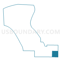
Outline

Summary
| Unique Area Identifier | 596196 |
| Name | Voting District 0293970000008 |
| County | Charlevoix County |
| State | Michigan |
| Area (square miles) | 35.53 |
| Land Area (square miles) | 34.37 |
| Water Area (square miles) | 1.16 |
| % of Land Area | 96.72 |
| % of Water Area | 3.28 |
| Latitude of the Internal Point | 45.15817630 |
| Longtitude of the Internal Point | -84.80003480 |
Maps


Graphs
Select a template below for downloading or customizing gragh for Voting District 0293970000008, Charlevoix County, Michigan


Neighbors
Neighoring Voting District (by Name) Neighboring Voting District on the Map
- Voting District 0098330000001, Antrim County, MI
- Voting District 0290986000001, Charlevoix County, MI
- Voting District 0291456000002, Charlevoix County, MI
- Voting District 0295288000010, Charlevoix County, MI
- Voting District 0318764000001, Cheboygan County, MI
- Voting District 1371832000001, Otsego County, MI
- Voting District 1372562000001, Otsego County, MI
- Voting District 1374814000001, Otsego County, MI
Top 10 Neighboring County Subdivision (by Population) Neighboring County Subdivision on the Map
- Livingston township, Otsego County, MI (2,525)
- Corwith township, Otsego County, MI (1,748)
- Elmira township, Otsego County, MI (1,687)
- Melrose township, Charlevoix County, MI (1,403)
- Boyne Valley township, Charlevoix County, MI (1,195)
- Wilmot township, Cheboygan County, MI (878)
- Hudson township, Charlevoix County, MI (691)
- Warner township, Antrim County, MI (416)
- Chandler township, Charlevoix County, MI (248)
Top 10 Neighboring Unified School District (by Population) Neighboring Unified School District on the Map
- Gaylord Community Schools, MI (20,186)
- Petoskey Public Schools, MI (18,391)
- Wolverine Community Schools, MI (2,838)
- Vanderbilt Area Schools, MI (2,082)
- Boyne Falls Public School District, MI (1,729)
Top 10 Neighboring State Legislative District Lower Chamber (by Population) Neighboring State Legislative District Lower Chamber on the Map
Top 10 Neighboring State Legislative District Upper Chamber (by Population) Neighboring State Legislative District Upper Chamber on the Map
Top 10 Neighboring 111th Congressional District (by Population) Neighboring 111th Congressional District on the Map
Top 10 Neighboring Census Tract (by Population) Neighboring Census Tract on the Map
- Census Tract 9502, Otsego County, MI (5,592)
- Census Tract 9608, Cheboygan County, MI (3,779)
- Census Tract 9602, Antrim County, MI (3,388)
- Census Tract 9501, Otsego County, MI (2,801)
- Census Tract 1, Charlevoix County, MI (1,650)